
游仙区 topographic map
Interactive map
Click on the map to display elevation.
About this map
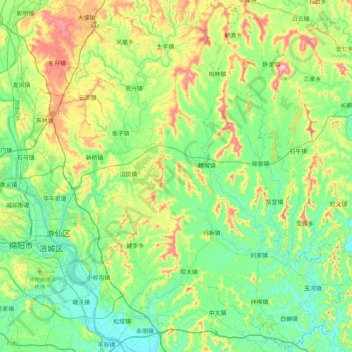
Name: 游仙区 topographic map, elevation, terrain.
Location: 游仙区, 绵阳市, 四川省, 中国 (31.34669 104.70027 31.72292 105.15156)
Average elevation: 514 m
Minimum elevation: 424 m
Maximum elevation: 735 m
Other topographic maps
Click on a map to view its topography, its elevation and its terrain.