
大通镇 topographic map
Interactive map
Click on the map to display elevation.
About this map
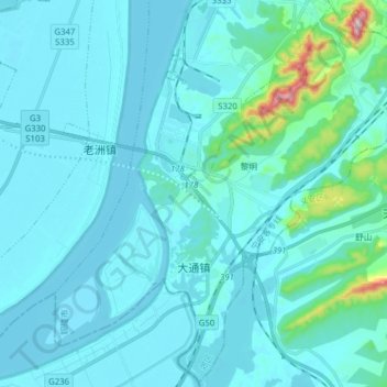
Name: 大通镇 topographic map, elevation, terrain.
Location: 大通镇, 郊区, 铜陵市, 安徽省, 中国 (30.77560 117.69559 30.90607 117.85174)
Average elevation: 41 m
Minimum elevation: 0 m
Maximum elevation: 467 m
Other topographic maps
Click on a map to view its topography, its elevation and its terrain.