
家朋乡 topographic map
Interactive map
Click on the map to display elevation.
About this map
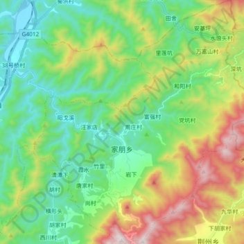
Name: 家朋乡 topographic map, elevation, terrain.
Location: 家朋乡, 绩溪县, 宣城市, 安徽省, 中国 (30.19046 118.75703 30.31717 118.89021)
Average elevation: 526 m
Minimum elevation: 154 m
Maximum elevation: 1,335 m
Other topographic maps
Click on a map to view its topography, its elevation and its terrain.