
井欄樹 topographic map
Interactive map
Click on the map to display elevation.
About this map
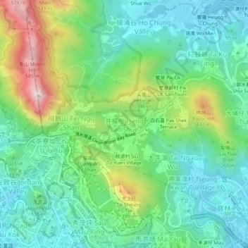
Name: 井欄樹 topographic map, elevation, terrain.
Location: 井欄樹, 西貢區, 新界, 香港, 000000, 中国 (22.31604 114.21820 22.35604 114.25820)
Average elevation: 176 m
Minimum elevation: -1 m
Maximum elevation: 590 m
Other topographic maps
Click on a map to view its topography, its elevation and its terrain.