
灰窰下 topographic map
Interactive map
Click on the map to display elevation.
About this map
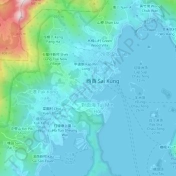
Name: 灰窰下 topographic map, elevation, terrain.
Location: 灰窰下, 西貢, 西貢區, 新界, 香港, 中国 (22.36054 114.24929 22.40054 114.28929)
Average elevation: 71 m
Minimum elevation: -3 m
Maximum elevation: 513 m
Other topographic maps
Click on a map to view its topography, its elevation and its terrain.