
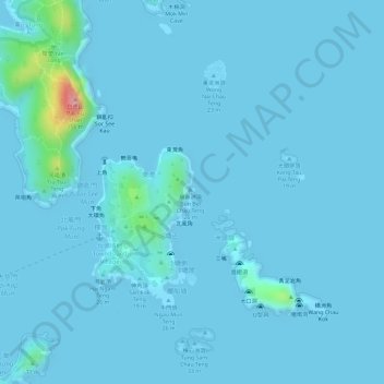
崩鼻洲 topographic map
Interactive map
Click on the map to display elevation.
About this map
Name: 崩鼻洲 topographic map, elevation, terrain.
Location: 崩鼻洲, 伙頭墳村, 西貢區, 新界, 香港, 中国 (22.33617 114.36756 22.33680 114.36802)
Average elevation: 7 m
Minimum elevation: -8 m
Maximum elevation: 127 m
Other topographic maps
Click on a map to view its topography, its elevation and its terrain.