
半見村 topographic map
Interactive map
Click on the map to display elevation.
About this map
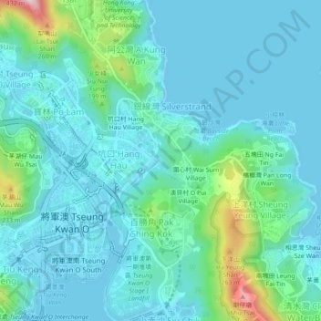
Name: 半見村 topographic map, elevation, terrain.
Location: 半見村, 將軍澳, 西貢區, 新界, 香港, 中国 (22.29637 114.25155 22.33637 114.29155)
Average elevation: 56 m
Minimum elevation: -2 m
Maximum elevation: 341 m
Other topographic maps
Click on a map to view its topography, its elevation and its terrain.