
栖霞区 topographic map
Interactive map
Click on the map to display elevation.
About this map
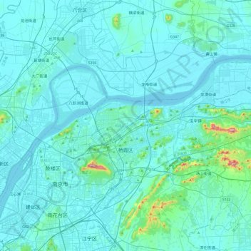
Name: 栖霞区 topographic map, elevation, terrain.
Location: 栖霞区, 南京市, 江苏省, 中国 (32.02752 118.75985 32.24706 119.23951)
Average elevation: 28 m
Minimum elevation: 0 m
Maximum elevation: 409 m
栖霞区地质构造属宁镇褶皱带。地势起伏大,地貌类型多。地形大势为南高北低。境内无海拔300米以上低山。
Other topographic maps
Click on a map to view its topography, its elevation and its terrain.