
方巷镇 topographic map
Interactive map
Click on the map to display elevation.
About this map
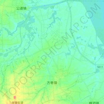
Name: 方巷镇 topographic map, elevation, terrain.
Location: 方巷镇, 邗江区, 扬州市, 江苏省, 225100, 中国 (32.48265 119.34753 32.59736 119.47511)
Average elevation: 13 m
Minimum elevation: 0 m
Maximum elevation: 56 m
Other topographic maps
Click on a map to view its topography, its elevation and its terrain.