
滨水绿地公园 topographic map
Interactive map
Click on the map to display elevation.
About this map
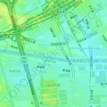
Name: 滨水绿地公园 topographic map, elevation, terrain.
Location: 滨水绿地公园, 东山街道, 江宁区, 南京市, 江苏省, 中国 (31.95820 118.78222 31.95998 118.80048)
Average elevation: 13 m
Minimum elevation: 6 m
Maximum elevation: 25 m
Other topographic maps
Click on a map to view its topography, its elevation and its terrain.