
蜈蚣山 topographic map
Interactive map
Click on the map to display elevation.
About this map
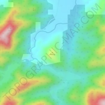
Name: 蜈蚣山 topographic map, elevation, terrain.
Location: 蜈蚣山, 江门市, 新会区, 广东省, 中国 (22.23988 113.01828 22.23998 113.01838)
Average elevation: 114 m
Minimum elevation: 6 m
Maximum elevation: 345 m
Other topographic maps
Click on a map to view its topography, its elevation and its terrain.