
开平市 topographic map
Interactive map
Click on the map to display elevation.
About this map
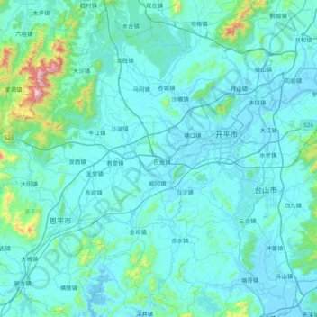
Name: 开平市 topographic map, elevation, terrain.
Location: 开平市, 江门市, 广东省, 529300, 中国 (21.97239 112.23036 22.66875 112.81145)
Average elevation: 81 m
Minimum elevation: -5 m
Maximum elevation: 1,225 m
最高山峰天露山,海拔1250米。主要河流有潭江,建有大沙河水库、镇海水库。
Other topographic maps
Click on a map to view its topography, its elevation and its terrain.