
乌猪洲 topographic map
Interactive map
Click on the map to display elevation.
About this map
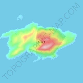
Name: 乌猪洲 topographic map, elevation, terrain.
Location: 乌猪洲, 台山市, 江门市, 广东省, 中国 (21.59685 112.85658 21.61760 112.90059)
Average elevation: 24 m
Minimum elevation: 0 m
Maximum elevation: 229 m
Other topographic maps
Click on a map to view its topography, its elevation and its terrain.