
王府洲 topographic map
Interactive map
Click on the map to display elevation.
About this map
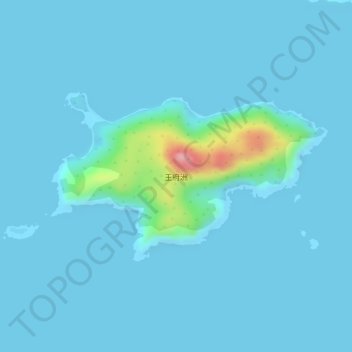
Name: 王府洲 topographic map, elevation, terrain.
Location: 王府洲, 台山市, 江门市, 广东省, 中国 (21.58960 112.57510 21.60262 112.59792)
Average elevation: 12 m
Minimum elevation: -1 m
Maximum elevation: 156 m
Other topographic maps
Click on a map to view its topography, its elevation and its terrain.