
二道区 topographic map
Interactive map
Click on the map to display elevation.
About this map
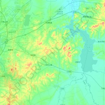
Name: 二道区 topographic map, elevation, terrain.
Location: 二道区, 长春市, 吉林省, 130000, 中国 (43.75504 125.34539 43.95771 125.81638)
Average elevation: 231 m
Minimum elevation: 171 m
Maximum elevation: 464 m
Other topographic maps
Click on a map to view its topography, its elevation and its terrain.