
帽儿山 topographic map
Interactive map
Click on the map to display elevation.
About this map
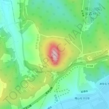
Name: 帽儿山 topographic map, elevation, terrain.
Location: 帽儿山, 小营镇, 延吉市, 延边朝鲜族自治州, 吉林省, 中国 (42.84015 129.46093 42.84025 129.46103)
Average elevation: 302 m
Minimum elevation: 215 m
Maximum elevation: 490 m
Other topographic maps
Click on a map to view its topography, its elevation and its terrain.