
碧水村 topographic map
Interactive map
Click on the map to display elevation.
About this map
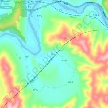
Name: 碧水村 topographic map, elevation, terrain.
Location: 碧水村, 图们市, 延边朝鲜族自治州, 吉林省, 中国 (42.97586 129.71149 43.01586 129.75149)
Average elevation: 197 m
Minimum elevation: 95 m
Maximum elevation: 396 m
Other topographic maps
Click on a map to view its topography, its elevation and its terrain.