
西安区 topographic map
Interactive map
Click on the map to display elevation.
About this map
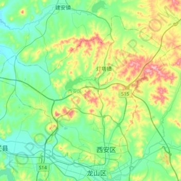
Name: 西安区 topographic map, elevation, terrain.
Location: 西安区, 辽源市, 吉林省, 中国 (42.90713 124.96901 43.06560 125.23166)
Average elevation: 300 m
Minimum elevation: 237 m
Maximum elevation: 463 m
Other topographic maps
Click on a map to view its topography, its elevation and its terrain.