Russia topographic maps
Click on a map to view its topography, its elevation and its terrain.
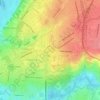
Chelyabinsk Oblast
The West Siberian Plain is bounded on the west horizontal (elevation 190 m above sea level), which passes through the village of Bagaryak, Kunashak and continues through Chelyabinsk to the south. The lowlands are located in the northeast, and the elevation drops to 130 m in the eastern border region.
Average elevation: 301 m
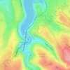
Ob River
The combined Ob-Irtysh system, the fourth-longest river system of Asia (after Yenisei, and China's Yangzi and Yellow rivers), is 5,410 kilometres (3,360 mi) long, and the area of its basin 2,990,000 square kilometres (1,150,000 sq mi). The river basin of the Ob consists mostly of steppe, taiga, swamps, tundra,…
Average elevation: 122 m
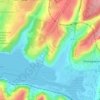
Барило-Крепинское сельское поселение
Russia > Rostov Oblast > Rodionovo-Nesvetaysky District
Average elevation: 135 m

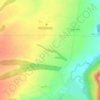
Omsk
Omsk is in the south of the West Siberian Plain, along the banks of the north-flowing Irtysh, at its confluence with the Om River. The city has an elevation of 87 meters (285 ft) above mean sea level at its highest point.
Average elevation: 107 m
Куморское эвенкийское сельское поселение
Russia > Buryatia > Severo-Baykalsky Rayon
Average elevation: 540 m