
Коломенка topographic map
Interactive map
Click on the map to display elevation.
About this map
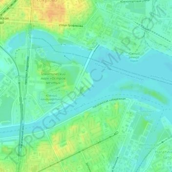
Name: Коломенка topographic map, elevation, terrain.
Average elevation: 125 m
Minimum elevation: 115 m
Maximum elevation: 144 m
Other topographic maps
Click on a map to view its topography, its elevation and its terrain.
Римский дворик
Римский дворик, 38, Arbat District, Moscow, Central Federal District, 121019, Russia
Average elevation: 145 m