
威整镇 topographic map
Interactive map
Click on the map to display elevation.
About this map
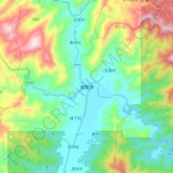
Name: 威整镇 topographic map, elevation, terrain.
Location: 威整镇, 肇庆市, 广东省, 中国 (23.60832 112.69093 23.68832 112.77093)
Average elevation: 251 m
Minimum elevation: 28 m
Maximum elevation: 687 m
Other topographic maps
Click on a map to view its topography, its elevation and its terrain.