
黄岗街道 topographic map
Interactive map
Click on the map to display elevation.
About this map
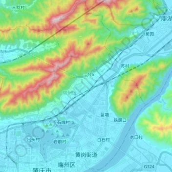
Name: 黄岗街道 topographic map, elevation, terrain.
Location: 黄岗街道, 端州区, 肇庆市, 广东省, 中国 (23.04874 112.45511 23.17501 112.54304)
Average elevation: 159 m
Minimum elevation: -9 m
Maximum elevation: 763 m
Other topographic maps
Click on a map to view its topography, its elevation and its terrain.