
带村 topographic map
Interactive map
Click on the map to display elevation.
About this map
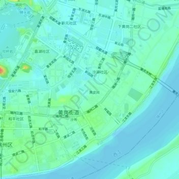
Name: 带村 topographic map, elevation, terrain.
Location: 带村, 黄岗街道, 端州区, 肇庆市, 广东省, 526020, 中国 (23.04680 112.48078 23.08680 112.52078)
Average elevation: 9 m
Minimum elevation: 0 m
Maximum elevation: 45 m