
永红湖 topographic map
Interactive map
Click on the map to display elevation.
About this map
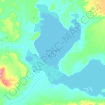
Name: 永红湖 topographic map, elevation, terrain.
Location: 永红湖, 索加乡, 治多县, 玉树藏族自治州, 青海省, 中国 (35.18925 89.89454 35.32043 90.06717)
Average elevation: 4,792 m
Minimum elevation: 4,770 m
Maximum elevation: 4,913 m
Other topographic maps
Click on a map to view its topography, its elevation and its terrain.