
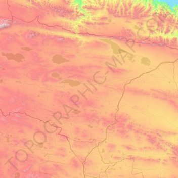
唐古拉镇 topographic map
Interactive map
Click on the map to display elevation.
About this map
Name: 唐古拉镇 topographic map, elevation, terrain.
Location: 唐古拉镇, 格尔木市, 海西蒙古族藏族自治州, 青海省, 中国 (33.86662 92.04867 36.37545 94.86185)
Average elevation: 4,756 m
Minimum elevation: 3,381 m
Maximum elevation: 6,537 m
唐古拉山镇地处青藏高原腹地、三江源自然保护区内,长江正源沱沱河位于境内,全镇平均海拔在4700米以上,属内陆高寒气候区,生态环境极其脆弱。辖区北靠可可西里国家自然保护区,东邻玉树州治多县、杂多县,西南与西藏自治区接壤,是格尔木市的一块飞地。
Other topographic maps
Click on a map to view its topography, its elevation and its terrain.