
郭勒木德镇 topographic map
Interactive map
Click on the map to display elevation.
About this map
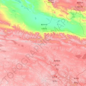
Name: 郭勒木德镇 topographic map, elevation, terrain.
Location: 郭勒木德镇, 格尔木市, 海西蒙古族藏族自治州, 青海省, 中国 (34.34675 89.80811 36.99472 95.70864)
Average elevation: 4,035 m
Minimum elevation: 2,659 m
Maximum elevation: 5,841 m
Other topographic maps
Click on a map to view its topography, its elevation and its terrain.