
杨陵区 topographic map
Interactive map
Click on the map to display elevation.
About this map
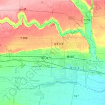
Name: 杨陵区 topographic map, elevation, terrain.
Location: 杨陵区, 咸阳市, 陕西省, 中国 (34.22238 107.94178 34.33482 108.13199)
Average elevation: 488 m
Minimum elevation: 429 m
Maximum elevation: 580 m
Other topographic maps
Click on a map to view its topography, its elevation and its terrain.