
罗岗镇 topographic map
Interactive map
Click on the map to display elevation.
About this map
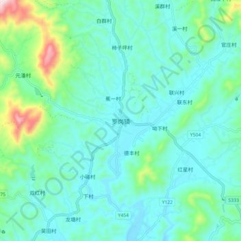
Name: 罗岗镇 topographic map, elevation, terrain.
Location: 罗岗镇, 梅州市, 广东省, 中国 (24.38500 115.59255 24.46500 115.67255)
Average elevation: 257 m
Minimum elevation: 159 m
Maximum elevation: 691 m
Other topographic maps
Click on a map to view its topography, its elevation and its terrain.