
大頭嶺村 topographic map
Interactive map
Click on the map to display elevation.
About this map
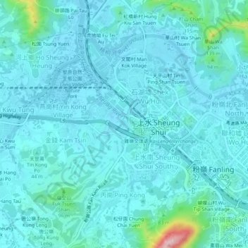
Name: 大頭嶺村 topographic map, elevation, terrain.
Location: 大頭嶺村, 北區, 新界, 香港, 518005, 中国 (22.48179 114.10269 22.52179 114.14269)
Average elevation: 25 m
Minimum elevation: -2 m
Maximum elevation: 228 m
Other topographic maps
Click on a map to view its topography, its elevation and its terrain.