
大村镇 topographic map
Interactive map
Click on the map to display elevation.
About this map
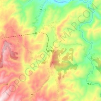
Name: 大村镇 topographic map, elevation, terrain.
Location: 大村镇, 古蔺县, 泸州市, 四川省, 中国 (27.97858 106.10339 28.05858 106.18339)
Average elevation: 954 m
Minimum elevation: 487 m
Maximum elevation: 1,432 m
Other topographic maps
Click on a map to view its topography, its elevation and its terrain.