
马蹄镇 topographic map
Interactive map
Click on the map to display elevation.
About this map
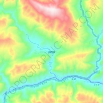
Name: 马蹄镇 topographic map, elevation, terrain.
Location: 马蹄镇, 古蔺县, 泸州市, 四川省, 中国 (27.70173 105.71960 27.78173 105.79960)
Average elevation: 870 m
Minimum elevation: 508 m
Maximum elevation: 1,479 m
Other topographic maps
Click on a map to view its topography, its elevation and its terrain.