
马嘶苗族乡 topographic map
Interactive map
Click on the map to display elevation.
About this map
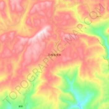
Name: 马嘶苗族乡 topographic map, elevation, terrain.
Location: 马嘶苗族乡, 古蔺县, 泸州市, 四川省, 中国 (27.77569 105.80586 27.85569 105.88586)
Average elevation: 1,189 m
Minimum elevation: 701 m
Maximum elevation: 1,521 m
Other topographic maps
Click on a map to view its topography, its elevation and its terrain.