
龙溪镇 topographic map
Interactive map
Click on the map to display elevation.
About this map
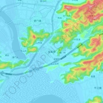
Name: 龙溪镇 topographic map, elevation, terrain.
Location: 龙溪镇, 台州市, 浙江省, 中国 (28.15574 121.26565 28.23574 121.34565)
Average elevation: 38 m
Minimum elevation: -2 m
Maximum elevation: 251 m
Other topographic maps
Click on a map to view its topography, its elevation and its terrain.