
长腰山 topographic map
Interactive map
Click on the map to display elevation.
About this map
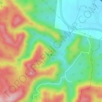
Name: 长腰山 topographic map, elevation, terrain.
Location: 长腰山, 台州市, 浙江省, 中国 (29.04362 121.19397 29.04372 121.19407)
Average elevation: 183 m
Minimum elevation: 72 m
Maximum elevation: 336 m
Other topographic maps
Click on a map to view its topography, its elevation and its terrain.