Geolocate

闲林村 topographic map

Interactive map

Click on the map to display elevation.

About this map

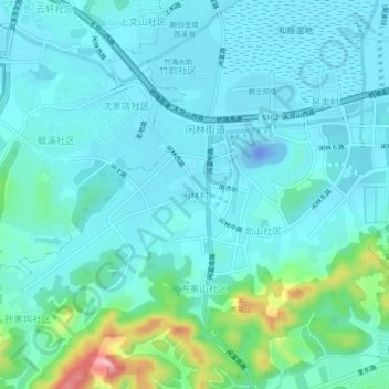
Name: 闲林村 topographic map, elevation, terrain.

Location: 闲林村, 余杭区, 浙江省, 311122, 中国 (30.20732 119.95725 30.24732 119.99725)

Average elevation: 31 m

Minimum elevation: -44 m

Maximum elevation: 189 m

Other topographic maps

Click on a map to view its topography, its elevation and its terrain.

三白潭

中国 > 浙江省 > 余杭区

三白潭, 仁和街道, 余杭区, 杭州市, 浙江省, 中国

Average elevation: 4 m

梁家塘

中国 > 浙江省 > 余杭区

梁家塘, 良渚街道, 余杭区, 杭州市, 浙江省, 310030, 中国

Average elevation: 9 m

北岸村

中国 > 浙江省 > 余杭区

北岸村, 仓前街道, 余杭区, 杭州市, 浙江省, 311121, 中国

Average elevation: 7 m

径山镇

中国 > 浙江省 > 余杭区

径山镇, 余杭区, 杭州市, 浙江省, 311116, 中国

Average elevation: 67 m

南湖

中国 > 浙江省 > 余杭区

南湖, 余杭街道, 余杭区, 杭州市, 浙江省, 中国

Average elevation: 10 m

马家村

中国 > 浙江省 > 余杭区 > 仓前街道

马家村, 仓前街道, 余杭区, 杭州市, 浙江省, 311121, 中国

Average elevation: 7 m

仓前街道

中国 > 浙江省 > 余杭区

仓前街道, 余杭区, 杭州市, 浙江省, 311121, 中国

Average elevation: 7 m

塔山公园

中国 > 浙江省 > 余杭区 > 余杭街道

塔山公园, 文昌社区, 余杭街道, 余杭区, 杭州市, 浙江省, 中国

Average elevation: 9 m