
Engerdal topographic map
Interactive map
Click on the map to display elevation.
About this map
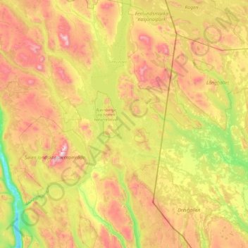
Name: Engerdal topographic map, elevation, terrain.
Location: Engerdal, Innlandet, Norvège (61.57454 11.51002 62.37448 12.29935)
Average elevation: 793 m
Minimum elevation: 249 m
Maximum elevation: 1,732 m
Other topographic maps
Click on a map to view its topography, its elevation and its terrain.