
黄陂区 topographic map
Interactive map
Click on the map to display elevation.
About this map
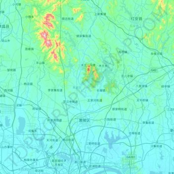
Name: 黄陂区 topographic map, elevation, terrain.
Location: 黄陂区, 武汉市, 湖北省, 中国 (30.66740 114.15196 31.36224 114.61583)
Average elevation: 64 m
Minimum elevation: 13 m
Maximum elevation: 817 m
Other topographic maps
Click on a map to view its topography, its elevation and its terrain.