
发展河哈尼族乡 topographic map
Interactive map
Click on the map to display elevation.
About this map
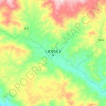
Name: 发展河哈尼族乡 topographic map, elevation, terrain.
Location: 发展河哈尼族乡, 澜沧拉祜族自治县, 普洱市, 云南省, 665000, 中国 (22.29400 100.13200 22.37400 100.21200)
Average elevation: 1,557 m
Minimum elevation: 1,246 m
Maximum elevation: 1,977 m
Other topographic maps
Click on a map to view its topography, its elevation and its terrain.