
惠民镇 topographic map
Interactive map
Click on the map to display elevation.
About this map
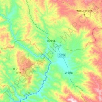
Name: 惠民镇 topographic map, elevation, terrain.
Location: 惠民镇, 澜沧拉祜族自治县, 普洱市, 云南省, 中国 (22.10415 99.92735 22.36608 100.20305)
Average elevation: 1,254 m
Minimum elevation: 803 m
Maximum elevation: 2,103 m
Other topographic maps
Click on a map to view its topography, its elevation and its terrain.