
峨堡镇 topographic map
Interactive map
Click on the map to display elevation.
About this map
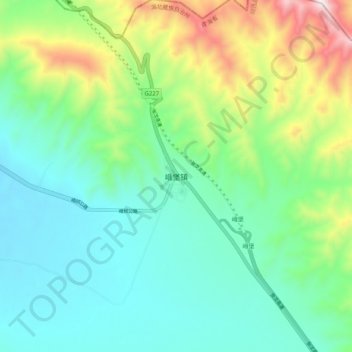
Name: 峨堡镇 topographic map, elevation, terrain.
Location: 峨堡镇, 祁连县, 海北藏族自治州, 青海省, 中国 (37.92799 100.89438 38.00799 100.97438)
Average elevation: 3,538 m
Minimum elevation: 3,310 m
Maximum elevation: 4,150 m
Other topographic maps
Click on a map to view its topography, its elevation and its terrain.