
黄藏寺村 topographic map
Interactive map
Click on the map to display elevation.
About this map
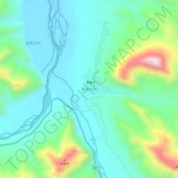
Name: 黄藏寺村 topographic map, elevation, terrain.
Location: 黄藏寺村, 祁连县, 海北藏族自治州, 青海省, 中国 (38.19925 100.17240 38.23925 100.21240)
Average elevation: 2,749 m
Minimum elevation: 2,602 m
Maximum elevation: 3,195 m
Other topographic maps
Click on a map to view its topography, its elevation and its terrain.