
长乐镇 topographic map
Interactive map
Click on the map to display elevation.
About this map
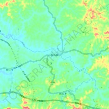
Name: 长乐镇 topographic map, elevation, terrain.
Location: 长乐镇, 高坪区, 南充市, 四川省, 中国 (30.75704 106.31979 30.83704 106.39979)
Average elevation: 323 m
Minimum elevation: 294 m
Maximum elevation: 404 m
Other topographic maps
Click on a map to view its topography, its elevation and its terrain.