
擦耳镇 topographic map
Interactive map
Click on the map to display elevation.
About this map
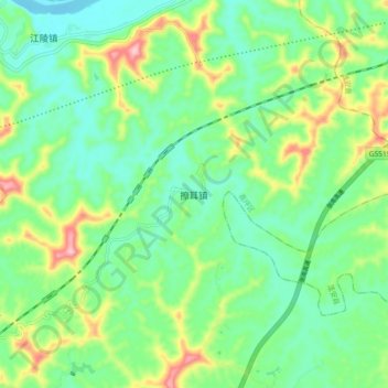
Name: 擦耳镇 topographic map, elevation, terrain.
Location: 擦耳镇, 高坪区, 南充市, 四川省, 中国 (30.86686 106.23601 30.94686 106.31601)
Average elevation: 333 m
Minimum elevation: 271 m
Maximum elevation: 473 m
Other topographic maps
Click on a map to view its topography, its elevation and its terrain.