
阙家镇 topographic map
Interactive map
Click on the map to display elevation.
About this map
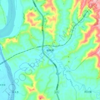
Name: 阙家镇 topographic map, elevation, terrain.
Location: 阙家镇, 高坪区, 南充市, 四川省, 中国 (30.62917 106.11061 30.70917 106.19061)
Average elevation: 317 m
Minimum elevation: 246 m
Maximum elevation: 555 m
Other topographic maps
Click on a map to view its topography, its elevation and its terrain.