
天目山镇 topographic map
Interactive map
Click on the map to display elevation.
About this map
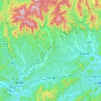
Name: 天目山镇 topographic map, elevation, terrain.
Location: 天目山镇, 临安区, 杭州市, 浙江省, 中国 (30.13992 119.39064 30.41527 119.56084)
Average elevation: 395 m
Minimum elevation: 63 m
Maximum elevation: 1,562 m
Other topographic maps
Click on a map to view its topography, its elevation and its terrain.