
青山湖街道 topographic map
Interactive map
Click on the map to display elevation.
About this map
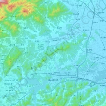
Name: 青山湖街道 topographic map, elevation, terrain.
Location: 青山湖街道, 临安区, 杭州市, 浙江省, 311305, 中国 (30.20132 119.68095 30.40318 119.86385)
Average elevation: 93 m
Minimum elevation: 3 m
Maximum elevation: 1,046 m
Other topographic maps
Click on a map to view its topography, its elevation and its terrain.