
岙里村 topographic map
Interactive map
Click on the map to display elevation.
About this map
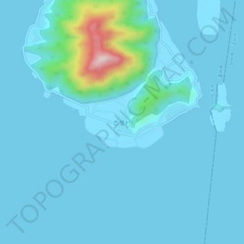
Name: 岙里村 topographic map, elevation, terrain.
Location: 岙里村, 温州市, 浙江省, 中国 (28.30639 121.16829 28.34639 121.20829)
Average elevation: 32 m
Minimum elevation: -1 m
Maximum elevation: 380 m
Other topographic maps
Click on a map to view its topography, its elevation and its terrain.