
上余 topographic map
Interactive map
Click on the map to display elevation.
About this map
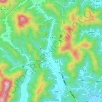
Name: 上余 topographic map, elevation, terrain.
Location: 上余, 开化县, 衢州市, 浙江省, 中国 (29.11552 118.33071 29.15552 118.37071)
Average elevation: 244 m
Minimum elevation: 126 m
Maximum elevation: 499 m
Other topographic maps
Click on a map to view its topography, its elevation and its terrain.