
杨岭头 topographic map
Interactive map
Click on the map to display elevation.
About this map
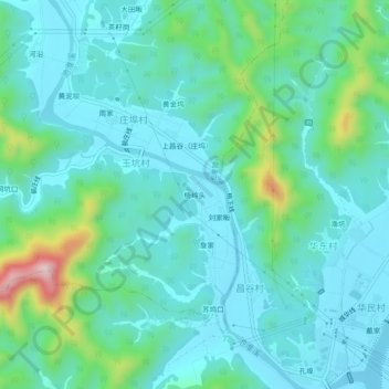
Name: 杨岭头 topographic map, elevation, terrain.
Location: 杨岭头, 池淮镇, 开化县, 衢州市, 浙江省, 中国 (29.02260 118.30972 29.06260 118.34972)
Average elevation: 167 m
Minimum elevation: 103 m
Maximum elevation: 434 m