
昭阳区 topographic map
Interactive map
Click on the map to display elevation.
About this map
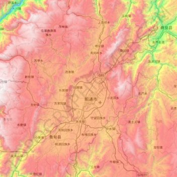
Name: 昭阳区 topographic map, elevation, terrain.
Location: 昭阳区, 昭通市, 云南省, 中国 (27.12097 103.14057 27.65264 103.93658)
Average elevation: 2,112 m
Minimum elevation: 476 m
Maximum elevation: 3,355 m
昭阳区被誉为中国黑颈鹤之乡,大山包海拔高,空气清新,为黑颈鹤主要过冬栖息地。
Other topographic maps
Click on a map to view its topography, its elevation and its terrain.